
City routes, live traffic, transit routes, parking, offline map and navigation.
We're excited to announce that we've updated 2GIS! The current version struggled to showcase all the detailed information we've gathered about cities and businesses. With the new 2GIS, we've revamped the design, introduced a new search feature, enhanced city updates, and seamlessly integrated favorites with 2gis.ru.
Services, Addresses, and Companies
2GIS is your go-to source for finding out which service providers operate in your building, locating your nearest district hospital, or finding a post office. It also helps you choose cafes or service centers based on reviews and photos, providing opening hours and contact numbers for an easy selection process.
Transport and Navigation
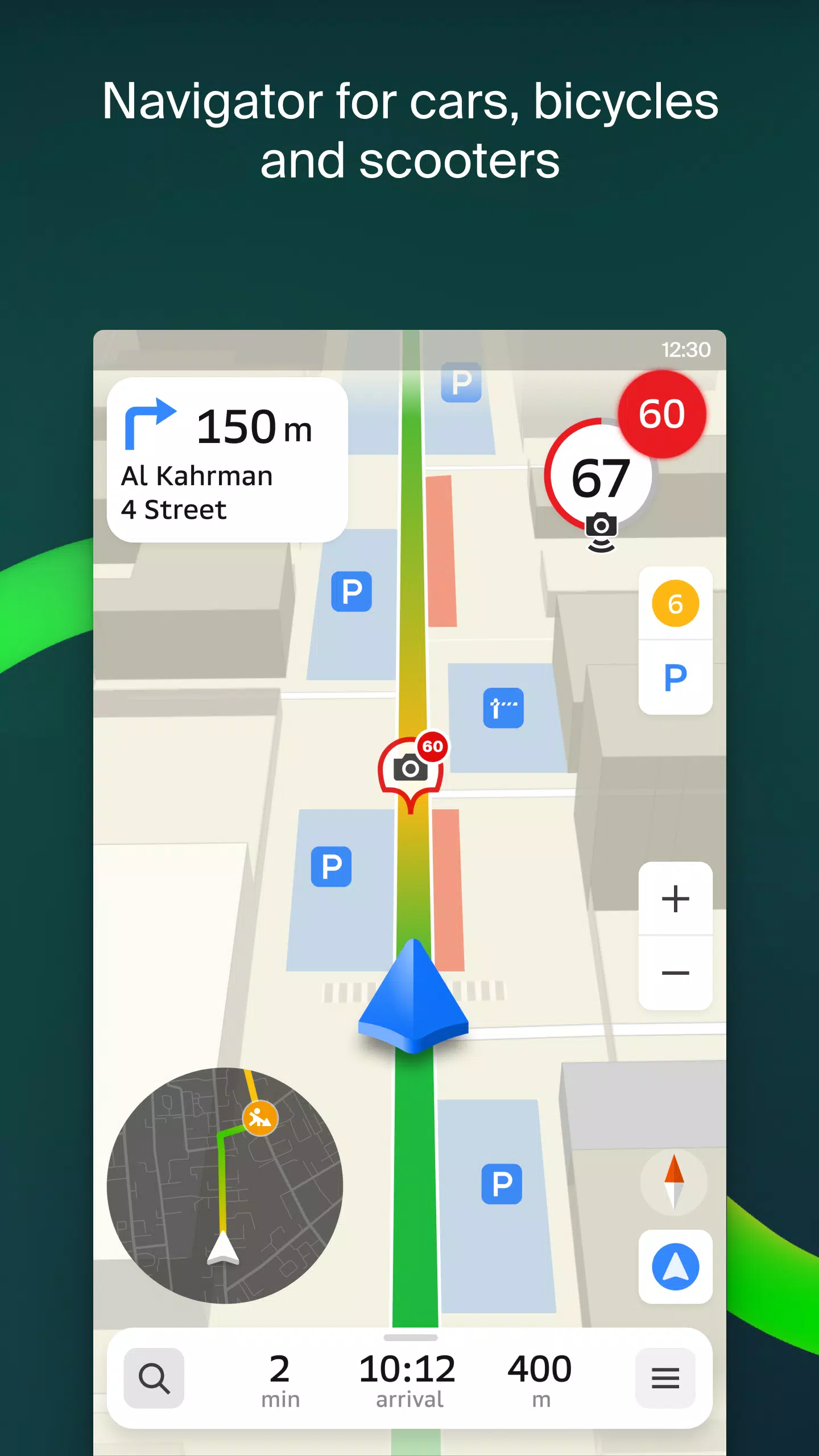
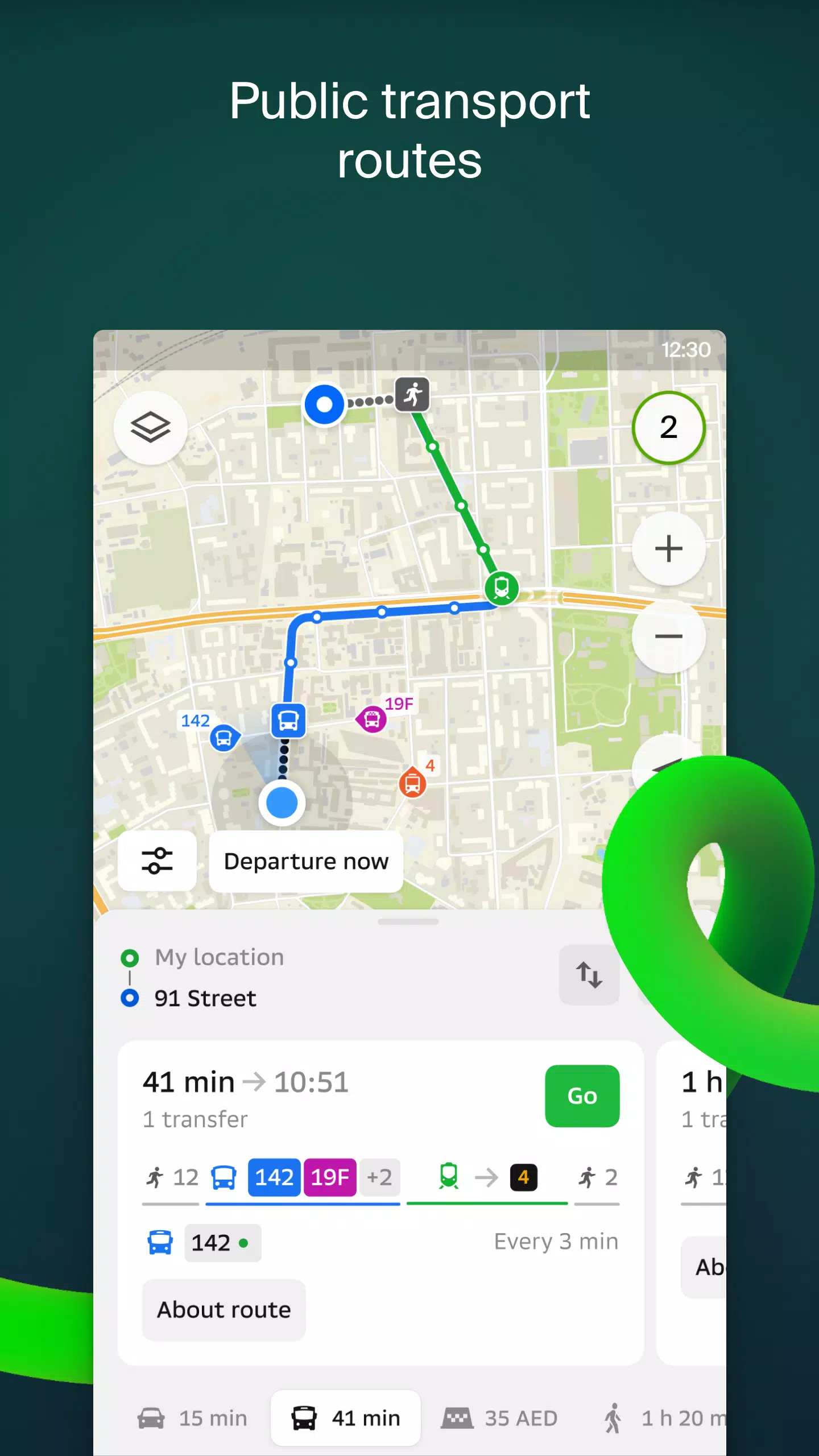
For drivers, 2GIS offers real-time navigation with voice instructions that guide you through your journey, taking into account traffic conditions and road closures. If you stray from your planned route, the app automatically recalculates to get you back on track. For pedestrians, it offers multiple transit options including buses, metro, trains, cable cars, and river trams.
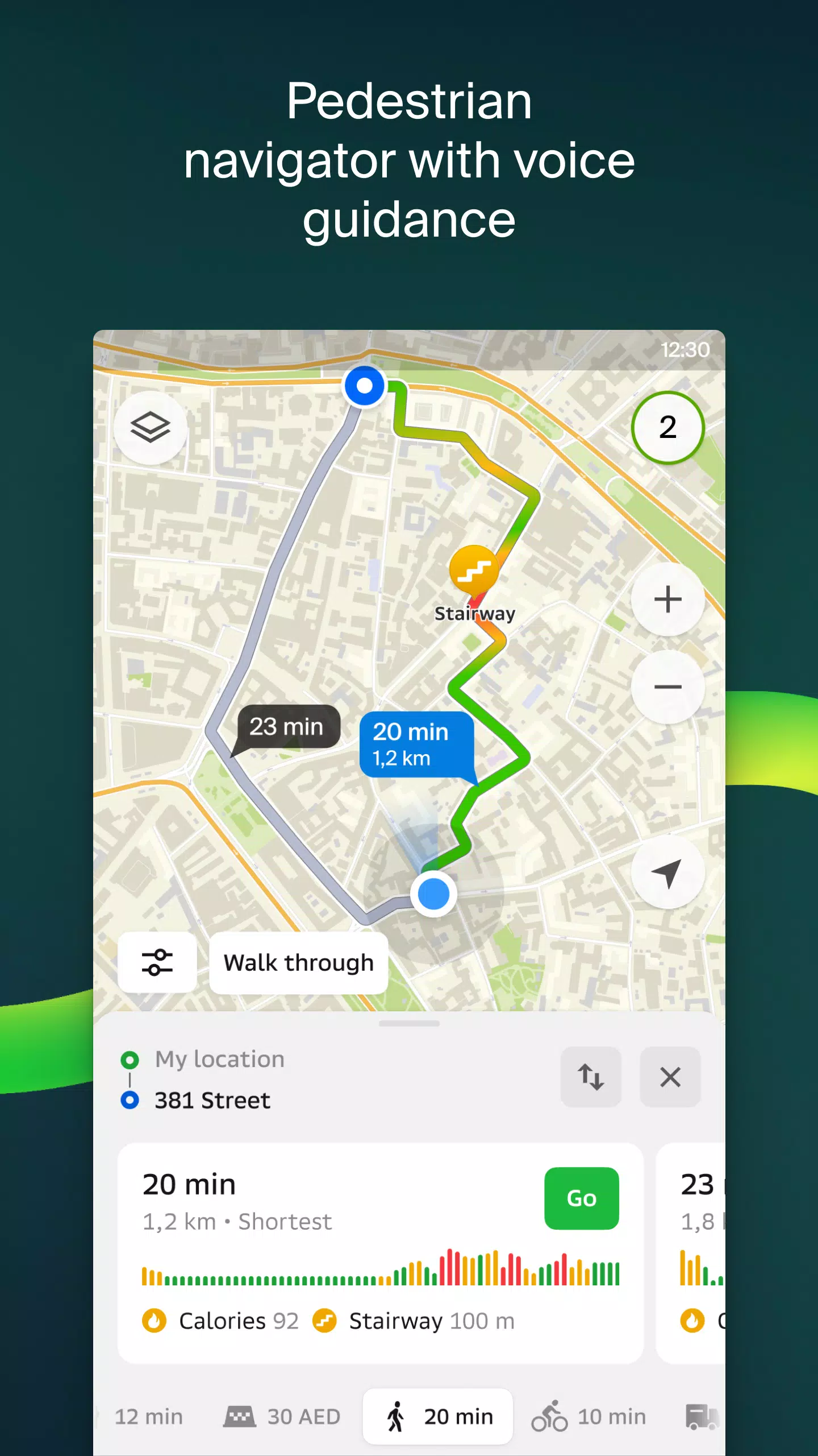
Walking Routes
Our pedestrian navigation system maps out the best routes for walking, complete with background operation and voice guidance to keep you on course.
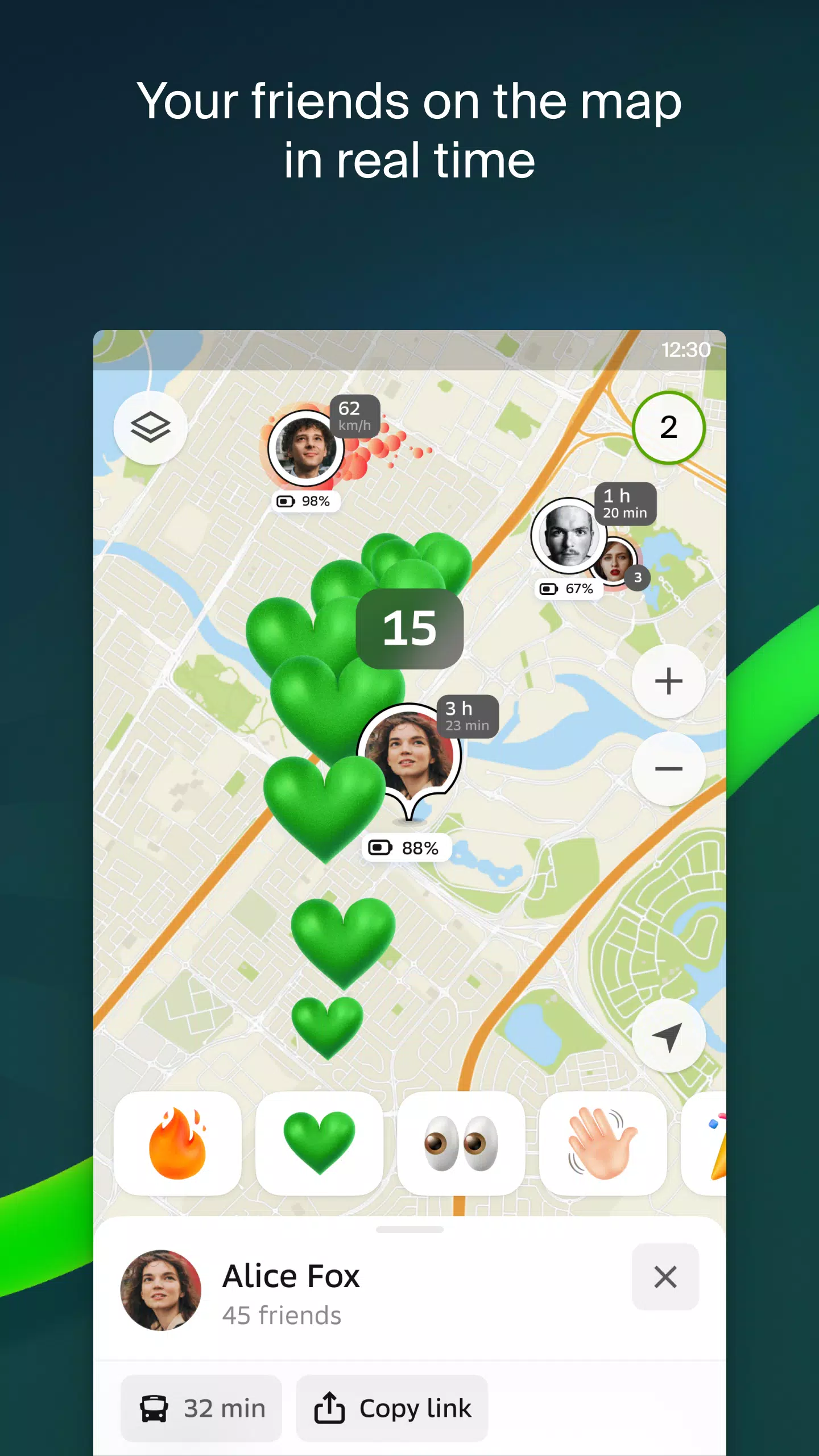
Friends on the Map
With 2GIS, you can now track the real-time location of friends and family on the map. You control who can see your location and manage your visibility settings easily.
Building Entrances
No more wandering around to find the right entrance! 2GIS provides detailed entry points for over 2.5 million businesses. Whether you're navigating by public transport or driving, we'll guide you right to the door.
Plans of Shopping Centers
Navigate shopping centers effortlessly with 2GIS. From stores and cafes to ATMs and restrooms, our app helps you plan your visit in advance, saving you time.
2GIS Beta Notifications Companion App for Smart Watches
Enhance your navigation experience with our new companion app for smart watches running Wear OS. It syncs seamlessly with the main 2GIS beta app, offering map views, maneuver hints, and vibration alerts for turns or arriving at bus stops. It activates automatically when you start navigation on your phone and is compatible with Wear OS 3.0 and later.
As a beta tester, you'll receive the latest updates as we fix bugs and improve the app. Your feedback helps shape the new version of 2GIS, which will soon be used by millions. You can run the beta version alongside the original without any need to uninstall – easily switch between the two as needed.
Support: [email protected]
What's New in the Latest Version 6.44.1.559.3
Last updated on Oct 19, 2024
We're thrilled to bring you beautiful, crisp updates in our latest version:
- Enjoy wide, realistic road displays on the main map and during route searches.
- Introducing Chats for Friends! Now you can message each other directly within the app without leaving the map view.
- Get notified when a friend is nearby; you can turn this off in settings if you prefer.
- Ski enthusiasts, rejoice! We've added ski lift status updates so you can see if they're open or closed.
- For public transport users, if your journey includes walking, we'll now calculate that part of your trip in steps.
6.44.1.559.3
179.3 MB
Android 6.0+
ru.dublgis.dgismobile4preview